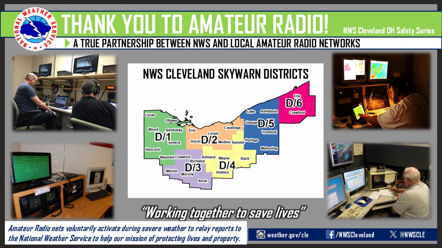
SPC Convective Outlooks
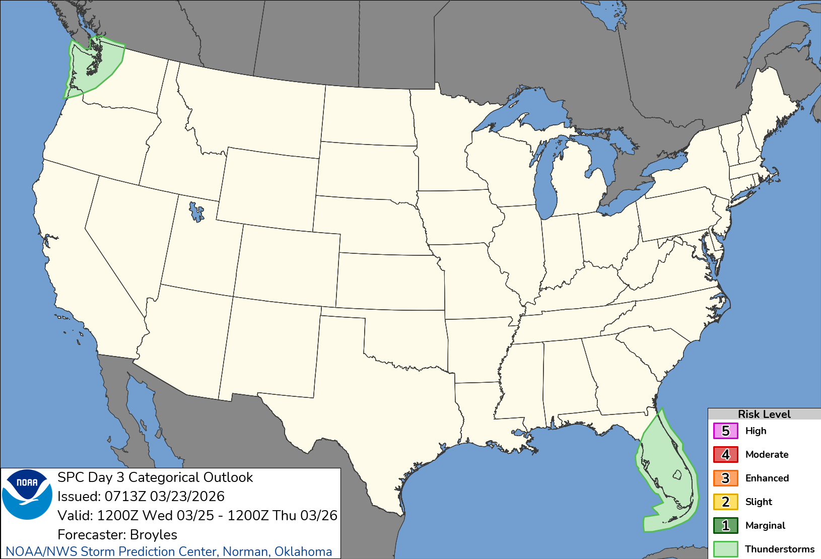
SPC 0730Z Day 3 Outlook
Day 3 Convective Outlook
NWS Storm Prediction Center Norman OK
0213 AM CDT Mon Mar 23 2026

Valid 251200Z - 261200Z

...NO SEVERE THUNDERSTORM AREAS FORECAST...

...SUMMARY...
No severe threat is expected across the U.S. on Wednesday and
Wednesday night.

...DISCUSSION...
A mid-level trough is forecast to move to the Eastern Seaboard on
Wednesday. The southern part of the trough will be over the Florida
Peninsula, where isolated to scattered thunderstorms will be
possible in the afternoon. Instability is forecast to be relatively
weak across the Florida Peninsula on Wednesday suggesting that
storms will likely remain below severe limits. Elsewhere, no severe
threat is expected over the continental U.S. on Wednesday and
Wednesday night.

..Broyles.. 03/23/2026
3:14 amMarch 23, 2026